Ouachita National Forest – GPS Offline Map Navigator 1.0
Paid Version
Publisher Description
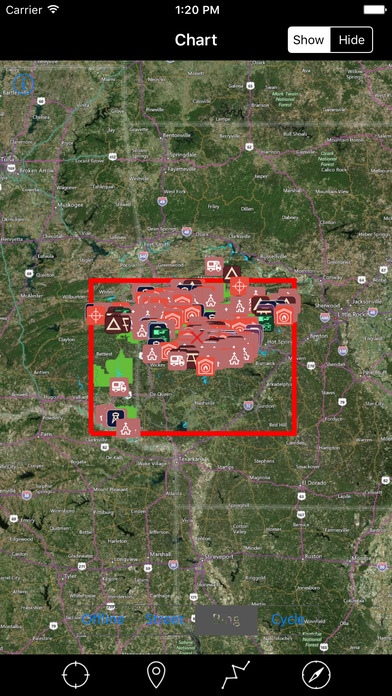
THE ALL NEW ADVANCED NATIONAL FOREST MAPS ARE FOR HIKERS, CAMPERS, ADVENTURE SEEKERS, NATURE LOVERS COMBINED FOR ALL RECREATIONAL ACTIVITIES! OFFLINE PARK MAP WITH INTEGRATED POINT OF INTERESTS & USEFUL MAP FUNCTIONALITY AT SMALL PRICE! HAVE FUN ALL THE TIME WITHOUT INTERNET CONNECTION! NATIONAL FOREST OFFLINE MAP COMPRISES ALL THE FOREST INFORMATION COLLECTED FROM THE NATIONAL FOREST SERVICE AND RELEVANT SOURCES. MAP CONTAINS ALL TYPES OF TRAILS, ATTRACTIONS, CAMPGROUNDS, FOOD POINTS, VISITOR CENTRE, PICNIC AREAS, PARKING AREAS, DRINKING WATER, RANGER STATION AND ALL POINT OF INTERESTS AVAILABLE WITHIN THE PARK COVERAGE. INCLUDES ALL LAKES, RIVERS, STREAMS, TRAILS! ROADS AND RAILWAYS! ALL PARK BOUNDARIES ARE FROM NATIONAL FOREST SERVICE! OTHER MAP FEATURES: TRACK YOUR LOCATION WITH GPS ON MAP. OFFLINE CHART OVERLAY DISPLAY, USE THEM AS LONG AS YOU HIKE, BIKE, WALK, CLIMB OR DO ANY ACTIVITY WITHIN THE FOREST. HIDE AND SHOW CHART OVERLAY TO SEE DIFFERENCE IN SATELLITE OR OTHER MAPS. INTERACTIVE COMPASS FOR DIRECTIONS (TRUE/MAGNETIC) INSERT UN-LIMITED FAVOURITE MARKERS ON MAP. PHOTO TAGGED FACILITY FOR MARKERS WITH EMAIL OPTION. FIND DISTANCES WITH ROUTE TOOL, DRAW ON MAP AND NAVIGATE ALONG THE ROUTE. THIS APP IS MOST ADVANCED WITH ALL THE NECESSARY TOOLS FOR EASY OFFLINE NAVIGATION. OVERLAY DISPLAY MANAGEMENT ON ALL MAP MODES EITHER ONLINE/OFFLINE IS MORE EASIER FOR HASSLE FREE FOREST TOUR. AS THERE WILL BE NO INTERNET IN NATIONAL FORESTS, THE OFFLINE CHART MODE IS FASTER AND CONVENIENT FOR UNINTERRUPTED NAVIGATION. NOTE: All data on map are embedded to match the exact location of features displayed on National Forest Service & reference sources but there may be some difference between the positions of actual objects. We are experts in GIS & IOS Apps development and strive to provide the best products to the end users. Any suggestions from the users of this product are welcome to make the app more useful. HAPPY NATIONAL FOREST RECREATION ALL THE TIME!
Requires iOS 8.0 or later. Compatible with iPhone, iPad, and iPod touch.
About Ouachita National Forest – GPS Offline Map Navigator
Ouachita National Forest – GPS Offline Map Navigator is a paid app for iOS published in the Recreation list of apps, part of Home & Hobby.
The company that develops Ouachita National Forest – GPS Offline Map Navigator is Vishwam B. The latest version released by its developer is 1.0.
To install Ouachita National Forest – GPS Offline Map Navigator on your iOS device, just click the green Continue To App button above to start the installation process. The app is listed on our website since 2016-09-05 and was downloaded 6 times. We have already checked if the download link is safe, however for your own protection we recommend that you scan the downloaded app with your antivirus. Your antivirus may detect the Ouachita National Forest – GPS Offline Map Navigator as malware if the download link is broken.
How to install Ouachita National Forest – GPS Offline Map Navigator on your iOS device:
- Click on the Continue To App button on our website. This will redirect you to the App Store.
- Once the Ouachita National Forest – GPS Offline Map Navigator is shown in the iTunes listing of your iOS device, you can start its download and installation. Tap on the GET button to the right of the app to start downloading it.
- If you are not logged-in the iOS appstore app, you'll be prompted for your your Apple ID and/or password.
- After Ouachita National Forest – GPS Offline Map Navigator is downloaded, you'll see an INSTALL button to the right. Tap on it to start the actual installation of the iOS app.
- Once installation is finished you can tap on the OPEN button to start it. Its icon will also be added to your device home screen.
